
What challenges do cities face, and how can planning help?
Answer in short
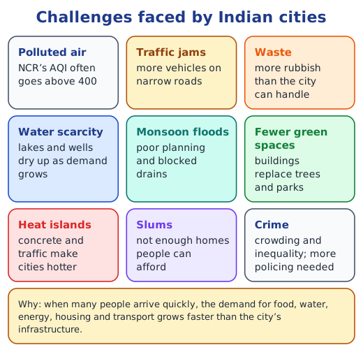
When many people crowd into a city, its roads, water, housing and services come under strain. Cities face traffic jams, polluted air, waste, slums, water shortages, floods and heat islands. Urban planning helps by deciding how land is used and how people move, as in Jaipur’s old grid plan and Singapore’s long-term plans.
Stuck on a question? Take a photo and Lagnever AI explains it step by step. Try it for 7 days for ₹2. Get it on Google Play
Why do cities face problems?
A city is built for a certain number of people. When far more people arrive than it was built for, they all need food, water, energy, homes and transport at once, and the city’s infrastructure cannot keep up. Roads are narrow and badly kept, new colonies spring up without proper water, drains or waste collection, and the number of vehicles keeps rising. Concrete, roads and traffic trap heat, so parts of a city become heat islands, hotter than the land around them.
How polluted is city air?
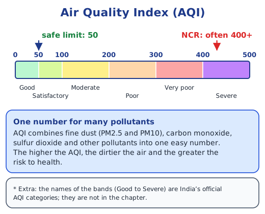
The Air Quality Index (AQI) turns the amounts of many pollutants, such as fine dust (PM2.5 and PM10), carbon monoxide and sulfur dioxide, into one simple number: the higher it is, the dirtier the air. The chapter gives 50 as the safe limit, yet the National Capital Region often records levels above 400, which is a serious risk to people’s health. Crowding and inequality can also mean more crime, so cities need more policing to keep people safe.
Why do slums grow?
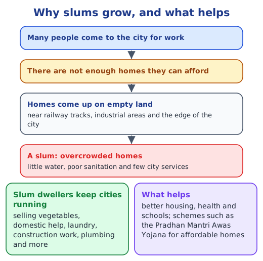
A slum is an overcrowded settlement with poor housing and little water, sanitation or other city services. Slums come up on empty land near railway tracks, industrial areas and the edge of a city, because there are not enough affordable homes for everyone who moves there. They exist in most countries. Yet slum dwellers keep cities running: they sell vegetables, work as domestic help, do laundry, build and plumb. Better housing, healthcare and schools for them are a key task, and schemes such as the Pradhan Mantri Awas Yojana give poorer households homes they can afford.
Saving water: Bengaluru’s lakes
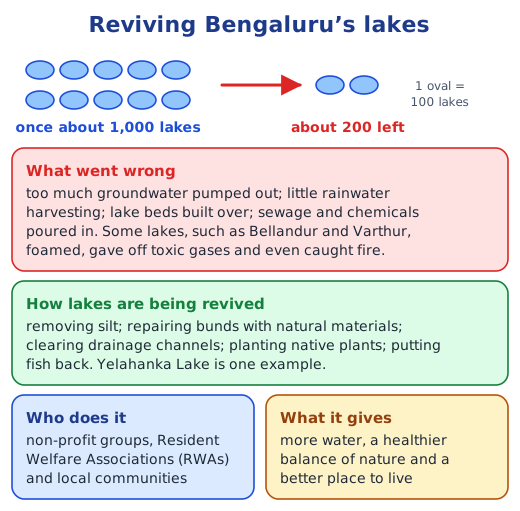
Bengaluru runs short of water every summer and floods every monsoon. Too much groundwater is pumped out, little rainwater is harvested, and lake beds have been built over. The city once had about 1,000 lakes; about 200 remain, and many were polluted by sewage and chemicals. Bellandur and Varthur lakes even foamed, gave off toxic gases and caught fire. Now non-profit groups, Resident Welfare Associations (RWAs) and local people are bringing lakes such as Yelahanka back to life: removing silt, repairing bunds with natural materials, clearing drains, planting native plants and putting fish back.
What does an urban planner do?
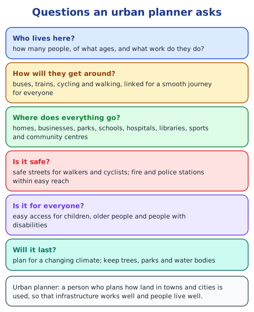
An urban planner decides how land in a town or city is used. Planners ask how many people live there and what work they do; how they will travel, and how buses, trains, cycling and walking can link up; where homes, businesses, parks, schools, hospitals and libraries should go; and how to make streets safe for walkers and cyclists, with fire and police stations close at hand. A city keeps changing, especially with a changing climate, so its plan must change too.
Jaipur: a city planned in 1727
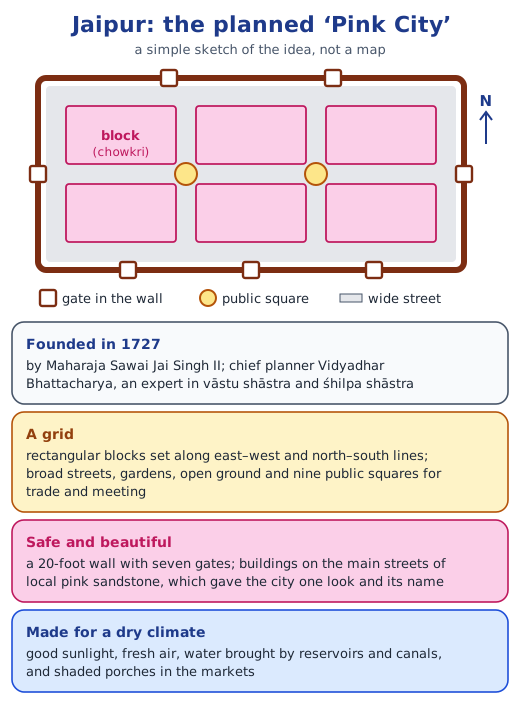
Maharaja Sawai Jai Singh II chose Vidyadhar Bhattacharya, an expert in vāstu shāstra and śhilpa shāstra, to design Jaipur. He laid it out as a grid of rectangular blocks called chowkris, lined up with the four directions, with wide streets, gardens and nine public squares for trade and meeting. A 20-foot wall with seven gates kept it safe, and buildings on the main streets were faced with local pink sandstone, which gave the city one look and its name. Sunlight, fresh air, reservoirs, canals and shaded market porches suited the dry climate.
Singapore: planning for the future
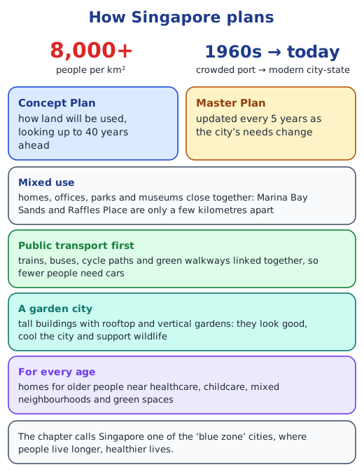
Singapore, a small island with over 8,000 people per km², grew from a crowded port in the 1960s into a modern city-state. Its Concept Plan looks up to 40 years ahead, and its Master Plan is updated every 5 years. Homes, offices and parks sit close together; trains, buses, cycle paths and green walkways reduce the need for cars; and tall buildings carry rooftop and vertical gardens.
In India, Ahmedabad’s Sabarmati Riverfront and Gangtok’s pedestrian-only M.G. Road show how public spaces can improve. Tools such as smart traffic signals and online complaint systems help too.
Read on: what is urbanisation?, cities as economic and cultural hubs, the chapter notes and the NCERT solutions.
Practice
-
An Air Quality Index of 400 means the air is:
Show answer
Answer: (c) badly polluted
-
Jaipur is called the ‘Pink City’ because:
Show answer
Answer: (b) buildings on its main streets were built of pink sandstone
-
Which of these helps to revive a lake?
Show answer
Answer: (b) removing silt and planting native plants
-
Name two kinds of work that slum dwellers often do for a city.
Show answer
Answer: Any two of: selling vegetables, domestic help, laundry, construction work and plumbing.
-
What is a mixed-use area?
Show answer
Answer: An area where homes, offices and places to relax, such as parks and museums, are close together, so people need to travel less.
Questions students ask
What are the main problems of Indian cities?
Crowding puts pressure on roads, water, housing and energy. The result is traffic jams, polluted air, piles of waste, slums, water shortages, floods in the monsoon, fewer green spaces, heat islands and, often, more crime.
What is urban planning?
It is deciding how land in a town or city is used: where homes, workplaces, parks, schools and hospitals go, how people travel, and how to keep streets safe, so that the city works well for everyone now and in the future.
Why is Jaipur called a planned city?
It was designed before it was built, in 1727, by Vidyadhar Bhattacharya for Maharaja Sawai Jai Singh II. He used a grid of rectangular blocks, wide streets, public squares, a wall with gates and pink sandstone fronts, and it still works much as planned.
What can Indian cities learn from Singapore?
To plan far ahead and update plans often; to keep homes, offices and parks close together; to link trains, buses, cycling and walking so fewer people need cars; and to add greenery on rooftops and walls.
Stuck on a question?
Take a photo and Lagnever AI explains it step by step. Try it for 7 days for ₹2.
Get it on Google Play Open in browser
For parents: after the trial, the plan renews monthly by UPI or card autopay. You can cancel anytime in the app.